
Sandakphu - A walk to Himalayan heaven
Trekking was always in my mind but was not
able to plan as my better half is not so keen in walking\trekking and planning
without her was out of question...!
It so happened that one of my colleague (Sagar)
went for Roopkund trek and seeing the untouched & scenic beauty of
mountains could resist from planning my own trek. So where to go...??? When to go..??? With
whom to go...?? Thoughts flowing all around me.

And
yes the same was going through most of my colleagues, we checked the calendar
and looked for long weekends, Jan having a long weekend and additional 1 day
leave will give us 4 days in hand for the trip. Next was location... we were
looking for 2 things... Scenic beauty and Snow... and the only 1 option that
fits in Sandakphu – A Trekkers Paradise.
The planning started with half mind as the
final approval from family was pending. However due to our Railway System,
needs to book the tickets 4 months early. Tickets were confirmed for 8 (Sagar,
Sandip, Biplab, Nagesh, Keshav, Agnimitra, Sandipan & myself).
With the Tickets confirmed, we did lots of
shopping as it was the first trek for most of us and none of us were equipped
with proper gears for Trekking in a subzero condition.
Day0: 25 Jan 2018 : Kolkata to NJP – Train
The day started with packing my stuffs as
the plan was to go directly from office... Am i forgetting something.. ok.. all
things packed... We started from ofc at 7:00 PM and after trying to book an
uber/ola for half an hour we were able
to book a cab and we reached Kolkata station just 15 minutes early... Agni da
was already waiting for us at the Station. . Sandipan was late and reached
staion just before the train start moving. Our train started exactly at 9:40 PM
from Kolkata station. With a hope that there will be no delay we slept.

12517/GHY GARIB RATH
Departs @ 21:40 (Avg on time), Platform#
5 KOAA/Kolkata
Arrives @ 07:45 +1 night (Avg 42m late)
Platform# 1A,1 NJP
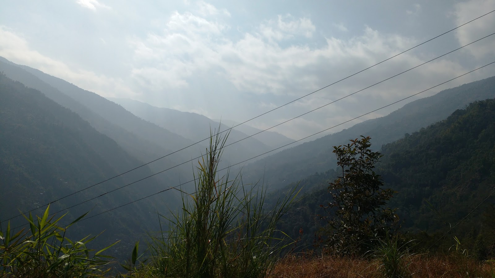
Day1: NJP - Manebanjean(Tavera) - Jhaubari (Landrover) - Gairibas (Trek)
The train reached NJP 1 hour late at around
8:45 AM,
Manebhanjan (also known as Mane Bhanjyang), Altitude: 7,054ft
Chitre (3kms
from Manebhanjan, Altitude: 8,340ft)
Lamaydhura (further
3kms, Altitude: 8,792ft)
Meghma (further 3kms, Altitude 9,514ft)
Tonglu (2kms
from Meghma, Altitude: 10,130ft)
Tumling (2kms
from Tonglu, Altitude: 9,600ft)
Jhaubari (6kms
from Tumling, Altitude: 9,186ft)
Gairibas (3
km from Jhaubari, Altitude: 8,600ft) Gairibas is the best place for the bird-watchers, these place
has a dense forest and which is very-very lonely. Red Panda (Allures Fulgens)
can also be seen in this forest. Besides these other animals are also found in
this area. In Gairibas both Government hut and Private lodges are found to make
night halt. We have a third Wildlife Forest Check Post, where every guide and
tourists has to register their names in this office and give their details of
the trek by the guide in this office and pay the park fee and collect the
permission for the trek if not done at Maneybhanjyang and Tumling Wildlife
Forest Check Post.


Day2: Gairibas - Kalpokhri - Sandakphu (Trekking)
Gairibas (1km
from Jhaubari, Altitude: 8,600ft)
KAIYAKATTA : 2kms from Gairibas, Altitude: 9,200ft) – Walking 2
km uphill through the forest of Rhododendron, Bamboos, Oak, we have a place
called Kaiyakatta, which is a Tea-Point for tourists.
Kalipokhri (4kms
from Gairibas, Altitude: 10,400ft) +3 hours trek – Kalapokhari is a Nepal village, where private
lodges are found to stay. The inhabitant of these village are Sherpa and
Bhutias. Kalapokhari got its name from the ‘Holy Pond’ which is black in color
(Kala = Black, Pokhari = Pond) Black Pond.
Bikheybhanjang (2kms
from Kalipokhri), +40 minutes trek – Bikeybhanjyang means valley of Poison. Where
poisonous flowers Aconite are found in plenty. From this place tourist has to
climb stiff uphill for 4 km. to reach Sandakphu
Sandakphu (further
4kms from Bikheybhanjang, Altitude: 11,929ft) 2.5 hours trek - Sandakphu is the highest point of Darjeeling
district and West Bengal. It is famous tourist spots in the world. Thousands of
tourists both domestic and International comes to see the panoramic view of the
gigantic Himalayas Ranges from Nepal to Sikkim, Arunachal Pradesh (India)
uptill Bhutan. The four famous mountains which are above 8000 mts. such as
Mount Everest, Mount Lhotse, Mount Makalu and Mount Kanchanjanga are viewed
from Sandakphu-Phalut area. Sunrise and Sunset of Sandkaphu is world famous.
If you started early in the morning, you
can complete your breakfast here or have some tea, before you proceed towards
Sandakphu. The stall also offers noodles, toast and other snack items, and even
meals. You can get packaged snacks, biscuits, soft drinks and bottled water
here as well. Opposite to the stall is a check post of Armed Border
Force.
The three routes that originate shortly
after entry to Singalila National Park (a concrete road through forest, a dirt
road through Jhaubari of Nepal, and a trekking trail) all come and meet here at
Gairibas.
Three routes meet at Gairibas. Below is
the main concrete road.
From upper right comes the route from
Jhaubari,
and at upper left is the trekking
trail.
There is a nice GTA lodge at Gairibas
(about 100 yards before you reach the check post and located at a lower level
on a grassy flat land). The landscape around is picturesque with pine trees and
lot other plantations. This is the best accommodation here.

During high season, it may not be easy
to get accommodation at Gairibas, unless you have booked it in advance. Because
of the scenic beauty of this place, many prefer to stay here for a night before
proceeding for Sadakphu next morning. Magnolia Lodge is also popular.
From Gairibas, the route is a steep climb
for about 2kms till you reach a tiny settlement known as Kaiyakatta.
There are only couple of stalls here where you can get refreshment and water.
The place gets its name from a strange story. A Marwari man used to run a
business here. Marwaris are locally known as Kaiya. However this man deprived
the locals to keep most profits for himself when one day a local came and
beheaded him (an act known as katta). The place is since known as
Kaiyakatta.


Kaiyakatta

From Kaiyakatta, there are two routes. The
trail at the upper level goes through Nepal. However most take the other route
that goes through India. Both routes finally meet at Kalipokhri where the lake
is located. From Kaiyakatta, it's a gradual climb till you reach
Kalipokhri.


Kalipokhri (6kms
from Gairibas, Altitude: 10,400ft) +3 hours trek
From Gairibas, the trek up to Kalipokhri
takes about three hours. It's at an altitude of 10,400 ft. Initially you will
trek uphill through forests of oak, rhododendrons and bamboo to reach Kaiyakatta in
about 1.5 hours which is about 2kms from Gairibas. The trail is up
& down from here. In another 1.5 hours or so you will reach
Kalipokhri.

Kalipokhri is so named because of a pond or
a water tank filled with black water. The word Kali means black and pokhri
stands for water area. However the black color is not due to pollution, it's
muddy and the water never freezes. The small lake is considered sacred by the
local villagers. Due to all-time water availability, a small village settlement
has taken place in this area (about 100 yards ahead at a higher level). This is
where all private trekkers huts are also located.

Kalipokhri Water Body
See the trail on upper right which comes
from
Kaiyakatta through Nepal and meets
here

You will pass through forest of
rhododendron, Singalila Sanctuary and then by the pond to reach the Kalipokhri
village area. This is where most of the trekkers stay for the second night.
There are several private lodges here including Pandim Lodge, Chewang Lodge,
and Himchuli Lodge.
There is no GTA lodge here, but the private
ones also offer similar accommodations at reasonable rates. Drinking water is
available at both Kaikatta and Kalipokhri villages. As you are entering the
village, look up 45 degrees towards left, and you can get the first real
glimpse of your targeted destination far away on a clear day...
Sandakphu.
If you are staying overnight at Kalipokhri,
start very early in the morning next day. You will not like to miss out on the
panoramic view of the snow peaks from Sandakphu, which is best seen early in
the morning. An early start from here will give you a chance to view the snow
peaks twice, once as soon as you reach Sandakphu and again next morning before
you start your return or onward trek.


Bikheybhanjang (2kms from Kalipokhri), +40 minutes trek
From Kalipokhri, the trekking route
gradually ascends up to Bikheybhanjang which is located 2kms away. On the way
you will cross a place called Chowri Chowk (there is no signboard though) where
you can take a break for couple of minutes. There is a hut here where mostly
drivers leaving tourists at Sandakphu come back for night stays. The lady there
will make a cup of tea for you.
Then walk towards Bikheybhanjang. This is
another small hamlet. The name means "Valley of Poison" because of
the poisonous Aconite plants that grow in abundance around this place. Don't
worry, The plant by itself is harmless unless you eat the leaves.

There is nothing much at Bikhey
Bhanjan. Once you come to the small tinned hut like structure on the right
(which is supposed to be a Check Post), you can see three routes ahead. The
gravel road steers along the right. A steep stairway right ahead climbs up to a
Stupa on top and then continues and meets the gravel road. And a trail on the
left passes through lovely meadows (this is also a motorable route, but very
steep and narrow). You can take any route, all finally merge.
Bikheybhanjang, see the 3
routes


Sandakphu (further
4kms from Bikheybhanjang, Altitude: 11,929ft) 2.5 hours trek
And now the final destination and the
climax. You could see the Sandakphu Peak from Kalipokhri itself. But like all
great things in life, this won't come easy. From Bikhheybhanjang the climb up
to Sandakphu is the steepest. The 4kms route can easily take about 2.5 hours.
There are stretches where the gradient is so steep that you will think your
nose is about to touch the ground.
But the final rewards are awesome.
All your strains will disappear as you see the board saying "Welcome to
Sandakphu". You are at an altitude of 11,929ft, on the summit of Singalila
range and at the paradise of trekking... Wow, you made it !!!


Day3: Sandakphu - Srikhola (Trekking)
Sandakphu
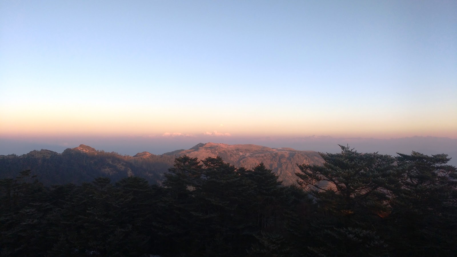
Sandakphu is the place from where you get a 180 degree panoramic vista of some of the highest and most beautiful peaks of the world, right from Nepal all the way up to Arunachal. Some of the greatest peaks include the Mt Everest, Makalu, Kanchenjunga, Lhotse, Chomolhari, Pandim, Three Sisters, Kumbhakarna etc. Visit Information about Sandakphu to know about all my experience there and what you can expect once you reach.
As the first sunlight strikes, you will see the dazzling peaks of the Everest family in Nepal at the far west including the gorgeous Mt. Everest (29,029 ft., the highest peak in the world). It is about 160kms away from Sandakphu. You will find it along with other peaks like Lhotse (27940 ft., the fourth highest peak) and Mt. Makalu (27,825 ft, the fifth highest peak). If you look further west, you will see the Chamlang (24,006 ft) that stands like a square wall of snow
If you now start looking towards east at Sikkim, you will see the striking and prominent peaks of Kanchenjunga family (summit 28,156 ft., the third highest peak in the world). The name Kanchenjunga means "Five treasures of the snow" and has five snow peaks in its family. It is characterized by massive mass of snow. Buddhists call it 'Sleeping Buddha' and this massif is considered a holy deity in Sikkim. It is because of this sacred belief, mountaineers are not permitted to climb to the peak of Kanchenjunga.
Other peaks close to Kanchenjunga include Kabru (24,026 ft), Kumbhakarna (25,294 ft.) and Pandim (22,010 ft). Between Everest and Kanchenjunga you will see the peaks of Three Sisters.
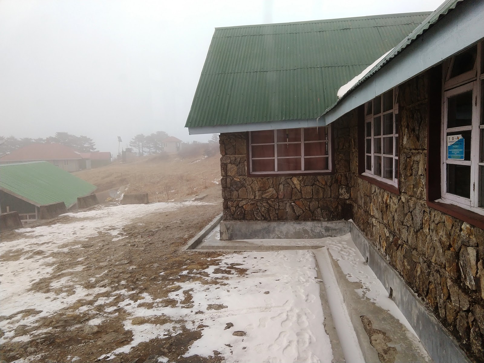
There is a GTA lodge in Sandakphu and also several other private accommodations including Hotel Sherpa Chalet, Hotel Sunrise, Namo Buddha Hotel etc. Sherpa Chalet is arguably the best hotel here and great for viewing the snow peaks from the rooms.


Gurudum (10kms
from Sandakphu, Altitude: 6,200ft) - Gurdum is 10 km down from Sandakphu and 5 km above Srikhola.
This trekking route is the alternative route for the people who had limited
time. Gurdum village is also a beautiful one. Here we have a private lodge,
which is the best lodge compare to Tumling lodge. Besides Gurdum, there is also
place called Timbura which is famous for home stay in this region.
Srikhola (5kms
from Gurudum, Altitude: 6,233ft)- Sirikhola is also a beautiful place to stay. It is on the
bank of Sri River. It is very lonely and beautiful place, whistling of birds,
sound of rivers, orating of crickets are awesome in this region.
The most popular return route from
Sandakphu is via Gurdum to Srikhola and then to Rimbik. The trail descends
through the dense Singalila forest full of oaks and chestnuts. There are some
places where even sunlight can't enter. You will find lots of flowering
rhododendron trees on the way that bloom in April and May.
Gurdum
This is one of the shortest routes. The
stretch from Sandakphu up to Gurdum is 10kms and can be covered in about 3.5
hours. Gurdum is a picture perfect tiny village. Only four or five families
live here. As you approach, you will see how the ridges full with dense trees
descend in the backdrop to the valley below. It's a wonderful sight. Some
trekkers plan to stay at Gurdum for a day to enjoy this beauty.


The village is surrounded by dense forests.
If you are lucky, you can even see animals like Himalayan bears (but never dare
to go close although they look cute). A villager offers a private hut to the
trekkers. You can also stay at the Himalayan Sherpa Hotel.
n
about 1.5 hours walk from Gurdum, you will reach another beautiful place
called Srikhola. The place has been named after a lovely mountain
stream which too has the same name (the word khola means a stream). There is a
GTA lodge next to the river.


This
is where many trekkers stay for the night as well. From here, Rimbik is another
7kms away. Most who stay overnight at Srikhola, take shared jeep next morning
from Srikhola that go all the way to Darjeeling via Rimbik, Maneybhanjan and
Ghoom.
Others
continue to trek up to Rimbik (3 hours from Srikhola), stay there overnight and
take early morning shared jeep from Rimbik to Siliguri.
Srikhola - GTA Lodge
What to See & Do in
Srikhola?
It's a paradise for nature lovers. Here
are the main attractions in Srikhola:
1) Beautiful meandering
& bouncing Srikhola river. Sit on the bank and enjoy.
2) Hanging wooden bridge.
3) Beautiful landscape with wooden
cottages having flowering gardens.
4) Srikhola is located at the foothill
of Singalila
National Park. You can visit the park and see animals like Red Panda,
Himalayan Black Bear, Barking Deer etc in natural habitat. Of course you must
be lucky to spot them.
5) In season, you can see a range of
flowers like rhododendrons, magnolia and orchids.
6) Walk through the forest of birch,
oaks and pine trees and enjoy the atmosphere.
7) Do fishing in the river ... lots of
trout fish. Shovraj Hotel provides fishing gears.
8) Visit gardens of cardamom (large
variety), peas and corn.
9) Spot birds like sparrows and blue
magpie.
10) Take a sightseeing tour of Srikhola
Village and visit monastery, temple and the hanging wooden bridge.
11) Take short trekking tours and visit
nearby villages like Rammam village, Timburey & Gurdum village, the
holy lake known as Jareao Pokhri etc.
Day4: Srikhola - Rimbick - NJP (Tavera)
Srikhola (5kms
from Gurudum, Altitude: 6,233ft)- Sirikhola is also a beautiful place to stay. It is on the
bank of Sri River. It is very lonely and beautiful place, whistling of birds,
sound of rivers, orating of crickets are awesome in this region.


Rimbick (7kms
from Tumling, Altitude: 7,000ft) – The last
point of the trek is Rimbick, which is also the last market of West Bengal and
Darjeeling district. Trekking ends at Rimbick and from here you have to drive
back by vehicles. But those who wants to spend their time in Rimbick there are
some sight-seeing like Rammam Hydel Project, Jhario Tar, Cave at Maney Dara,
Monasteries etc. Daily Jeep service for Darjeeling is available from Rimbick at
6am to 6:30am in the morning session and 11 am to 12 noon in the noon session.
Reserve taxi is also available there.

Some trekkers on their return route from
Sandakphu or Phalut end the trek at Srikhola and take a jeep from Srikhola for
onward travel to Darjeeling or NJP. However most prefer to continue the trek up
to Rimbik. The road initially rises and then levels out at Rimbik. From
Srikhola the distance to Rimbik is 7kms and takes about 2-hours walk. Rimbik is
a small village and there is a village market (bazaar) here. You get a
marvelous view of Darjeeling hill town from Rimbik.


Accommodations in Rimbik include
Rimbik Forest Bungalow, Youth Hostel, Hotel Green Hill and Kanchenjunga Hotel
(a budget hotel run by Sudip Chakraborty in Rimbik bazaar email: sudipjhuma@gmail.com)
etc. Stay near the market (bazaar) area, so that you can easily catch a shared
jeep early next morning for Darjeeling or Siliguri. Shared jeeps leave early in
the morning and go to Siliguri via Mirik. Darjeeling is about 4 hours by jeep from
Rimbik.

12378/PADATIK EXPRESS
Departs @ 17:45 (Avg 49m late) NOQ/New Alipurduar
Arrives @ 06:45 +1 night (Avg 2h 18m late) Platform# 9B SDAH/Sealdah
Day5 : 30 Jan 2018 : Reach Kolkata @ 8 AM (Train)
Reached at kolkata on time.


2 comments:
Simply loved the read.
lovely picture and glad u enjoyed check our andaman tour package
Post a Comment